Cruising Isle Royale
August 2003
Page 4
 |
Cruising Isle Royale August 2003 Page 4 |
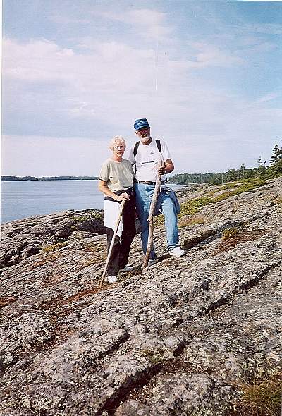
| While at Rock Harbor we took a five-mile hike out to Scoville Point, one of the windswept rock ridges jutting out from the northeast end of Isle Royale. The impenetrable forest beside the trail on the way out was incredible. It is difficult to imagine anyone “bushwhacking” very far. Seated on the edge of a ledge at the Point, a fellow approached, then called out to his wife, “Over here, Dorothy, some (lichen)!” So there they are, both of them, almost at our feet, peering intently at the lichen. Sensing that we were noting the exchange, the guy, who turned out to be an Academic Biologist, began giving Gayle and me a ten-minute brief on all of the species of moss and lichen one might expect to find on Isle Royale. Talk about “being in the right place, at the right time”! It was a loop trail, and the return passed a bluff overlooking Tobin Harbor, one of the fiord-like fingers of water at the north end of the Island. Park rangers had told us the previous evening that Tobin Harbor was home to the only loon rookery in the lower forty-eight states. Apparently there are about a hundred mature loons breeding here. |

| We left the Marina after the morning hike. The wind had flourished from the northwest following a brief rain front earlier that morning. The outlying islands, along with the multiple northeasterly points of Isle Royale itself disturbed the breeze, which seemed determined to be a headwind, if only it could decide from which direction, exactly. So we just fired up the Yammerhammer and satisfied ourselves with some sightseeing, at least as far as Blake Point, this sunny and very scenic afternoon. Gorgeous! Beyond Blake Point, the absolute northeast end of Isle Royale, the no longer fickle wind was solidly from the north, and fresh enough for a reef. Three to four foot waves originated somewhere up by Thunder Bay. Since we would be turning southwest onto a broad reach, I elected to set the full mains’l, and leave the jib and mizzen furled, thusly avoiding a reef. An unusual sailplan for us, but it worked wonderfully, giving us plenty of drive to almost keep pace with the seas, without having to pay critical attention to each gust. Amygdaloid Island, and the Amygdaloid channel lay ahead. Somehow the name had captured our imaginations. Actually this whole end of Isle Royale had captured my imagination decades ago. Would True North measure up? Was the Moby Skipper “prepared”, as a Boy Scout always should be? “Amygdaloid” comes from the small round cavities formed in molten rock by air bubbles, according to our handy cruising guide, Superior Way by Bonnie Dahl, a book to which we referred by the hour all week long. We had seen these bubbles in some of the stones on Atwood Beach and expected to see more here. The wind level and direction would not make this easy, the deep fork at the north end had waves running right into it, and four-mile flanks, both lakeside and channel, were swept by the gusty wind. That left only the deep fork at the south end. If that didn’t work for us, well, too bad about those Amygdaloids. McCargoe Cove, named after the British Captain McCargoe who kept his Warship, Recovery concealed in this very cove for the duration of the War Of 1812, lay just two miles further along. The same ship, by the way, was later used by Admiral Bayfield for charting Lake Superior in the early 1800's. While at McCargoe Cove we walked a mile of so around to the site of an old Copper Mine dating back hundreds of years. It was just a vertical pit, once almost a hundred feet deep, lined with stone like a well. I can think of few more difficult ways to earn a living. Apparently the mosquitoes and flies could drive hardy miners insane. After a Canadian family in a twenty-something I-O cruiser equipped with a noisy outboard-powered inflatable dinghy departed for Thunder Bay, we moved True North over to the pier for the night so we could use the pit latrines. |


