| On the 18th, we decided to try
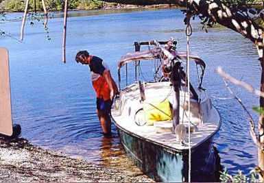
the Gulf of Mexico. It was low tide and even with our 9 inch draft
we had to carefully feel our way into deeper water. We needed to
get off the coast about a mile and a half before getting into four feet
of water. Turned north and finally got under sail with the Sanity's
single gaff rigged sail, which needed a single reef in the 15 knot breeze.
We had pre-plotted several timed compass legs, which came in handy along
the featureless coast. According to the chart, we passed several
major rivers, but even when scanning the coast with binoculars there was
no hint of their existence; the coast appeared to be a solid, unbroken
line of mangrove. After several hours we took a right and found the
piles that marked the channel into Lostmans River. Contrary to its
name we were successful in finding it. |


